Thunderstorm warnings issued for parts of UK with flash flooding expected

 Getty Images
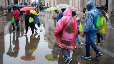
Yellow thunderstorm warnings have been issued across the UK, with heavy showers expected to lead to flash flooding and travel disruption.
The Met Office warnings will come into force across northern England, Northern Ireland and eastern Scotland later in the day on Wednesday. The warning for northern England will remain in place until Thursday morning.
The downpours follow almost two months of dry weather, with parts of the country experiencing their first rain in weeks on Tuesday.
People in areas impacted by thunderstorms have been told by the Met Office to expect that businesses and homes could flood, transport services could be delayed and power cuts are likely.
The yellow weather warnings are in place for:
- Northern Ireland from 12:00 until 23:59 BST on Wednesday
- Parts of North East Scotland, including Aberdeen, from 14:00 until 21:00 on Wednesday
- Parts of the North of England, including Manchester and Newcastle upon Tyne, from 19:00 until 10:00 on Thursday
The Met Office said lightning, hail and thunder were expected in the areas affected by warnings, with up to 30mm of rain expected within a few hours in parts of North East Scotland and across Northern Ireland.
Parts of northern England could see up to 50mm of rain within six hours.
Much of the UK has seen a mixture of sunshine and scattered showers already on Wednesday.
In Wisley, Surrey, a 62-day long dry spell was broken on Wednesday morning, with the remarkable run ending after 1.6mm fell before 10.00.
 PA Media
The Met Office has said this summer is likely to be the hottest on record, with the country experiencing five heatwaves so far.
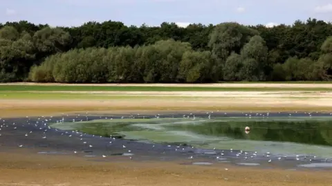
July 2026 was the driest July on record for England and Wales. Drought officials have declared 71.3% of England in drought, while parts of eastern Scotland are experiencing significant water scarcity.
Southern England has been worst affected, recording its driest month ever in records dating back to 1836.
While the shift in weather may bring welcome relief to areas experiencing drought, the Environment Agency has warned "sustained and significant rainfall" will be needed to alleviate the situation.
In such conditions, heavier showers can lead to flash flooding due to the ground being very hard and compacted, making it more water repellent and increasing run off.
 EPA
EPAWith high pressure giving way to low pressure for the rest of this week, rain is expected to become much more widespread over the next few days, although rainfall totals will be very uneven.
Temperatures will also fall across all areas as the week wears on, with daytime values returning to about, or perhaps even slightly below, the seasonal average for the first time in many weeks. Nights will turn noticeably chillier too.
Temperatures on Wednesday are likely to mark the first day since 29 June when maximum temperatures fail to reach 25°C (77°F).
The downward trend will then continue into Thursday and Friday, with temperatures falling further each day.
On Wednesday, the greatest chance of scattered heavy and thundery showers will affect the north of the UK, with Northern Ireland, parts of Scotland and northern England likely to see some of the heaviest downpours.
On Thursday, the focus of heavy, slow-moving and potentially thundery downpours will shift south, with the greatest chance of significant rainfall across parts of northern England, the Midlands, Lincolnshire, East Anglia and perhaps south-east England.
As is often the case with heavy showers, rainfall totals could vary considerably over short distances.
Some spots may pick up 20-30mm or more - particularly where showers repeatedly track over the same areas, while nearby locations could see much less - or even miss the showers altogether.
Further weather warnings could be issued for parts of England and Wales as heavy, potentially thundery showers continue through Thursday and into Friday.
 PA Media
Showers this week will not mean hosepipe bans - currently affecting more than 20 million people in the UK - are lifted, with water companies saying prolonged rainfall is needed to restore water levels.
Dry conditions have left landscapes yellow and parched over summer, but a sustained change in weather will also be needed for soil to be replenished and for browned grass to return to green.