|
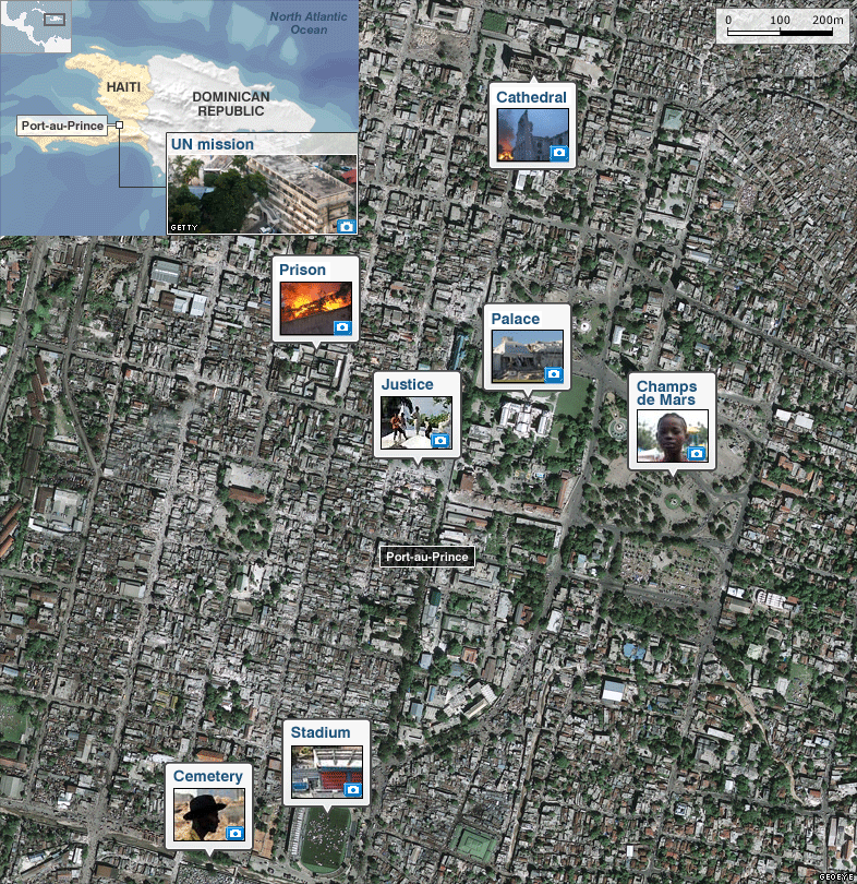
Satellite image of Port-au-Prince, Haiti taken on 13 January. It shows the aftermath of a 7.0-magnitude quake, Haiti's worst in two centuries, which struck at 1653 local time (2153 GMT) on Tuesday, just 15km (10 miles) south-west of Port-au-Prince. Click on the icons for more detailed images.
UN mission
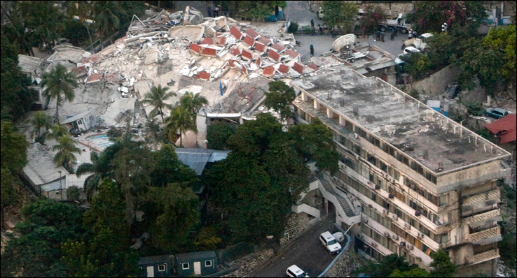
Between 100-150 people are still missing at the UN mission.
Prison
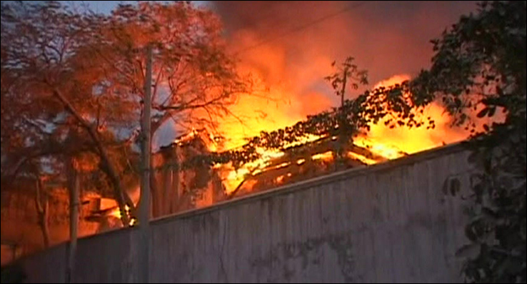
The collapse of the main prison led to the UN receiving reports of escaped prisoners.
Cathedral
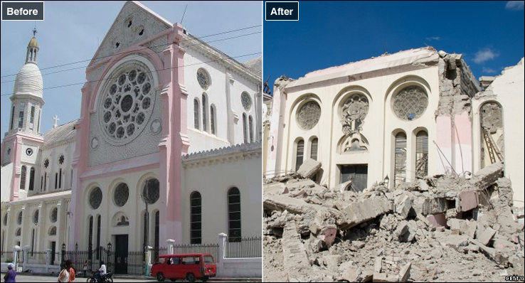
Roman Catholic Archbishop of Port-au-Prince, Monsignor Joseph Serge Miot died when his office collapsed with the main cathedral.
Palace
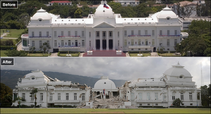
Before and after pictures show the destruction caused to the Presidential Palace.
Palace of Justice
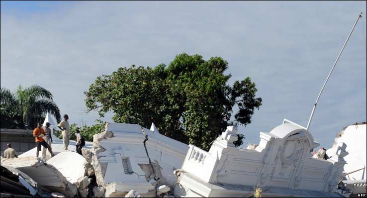
Local people stand amidst the rubble of the Palace of Justice.
Cemetery
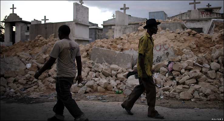
Even Port-au-Prince's cemetery shows scars from the earthquake.
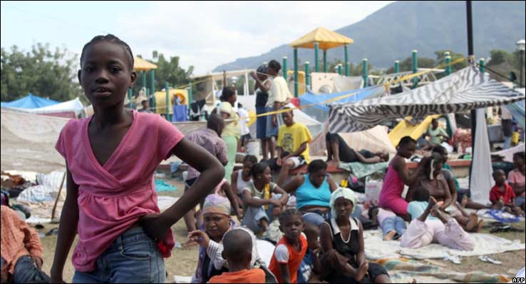
Stadium
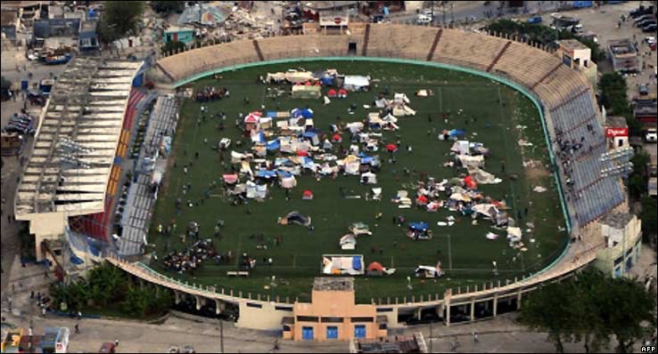
What was a sports ground has become a temporary shelter.
Champs de Mars
Families gather together in downtown Port-au-Prince.
Image: GeoEye Satellite Image
|

~RS~q~RS~~RS~z~RS~57~RS~)


Bookmark with:
What are these?