© Crown copyright. All rights reserved. BBC licence number 100019855, 2004.
Map not reproduced to scale.
Start Point: Matlock Bath Railway Station, off the A6, Derbyshire.
Countryside Rangers Office: 01629 816290
Ordnance Survey: Landranger Map 119, grid ref: SK2958
Distance: approx 3.2km (2 miles)
Time: approx 1 hour
Walk Conditions:
This is a point to point walk that can be converted into a circular.
The walk starts with a gentle incline and is on hard surface for the first half mile or so. The section from Starkholmes to the top of High Tor is on less structured surface with a relatively steep climb through the woods.
You're on a grassy path in open fields when you reach the top of the Tor. This stretch is relatively flat. Then it's windy paths with uneven surfaces down towards the River Derwent.
The final stretch of the walk is along the flat and into Matlock's parks. Easy access for everyone.
The walk ends in Matlock but for those wanting to get back to Matlock Bath there's the option of walking along Matlock's main street then alongside the Derwent and the A6.
You'll not be surprised to hear then that Matlock Bath is sometimes referred to as 'Little Switzerland'.
On a visit to Matlock Bath Lord Byron once made the comparison with Switzerland and it soon adopted the name 'Little Switzerland'.
At your starting point you'll notice that the station has a Swiss chalet style.
Today, Matlock
Bath's alpine character is emphasised by the cable car ride up to The
Heights of Abraham and the quaint higgledy-piggledy streets.
 |
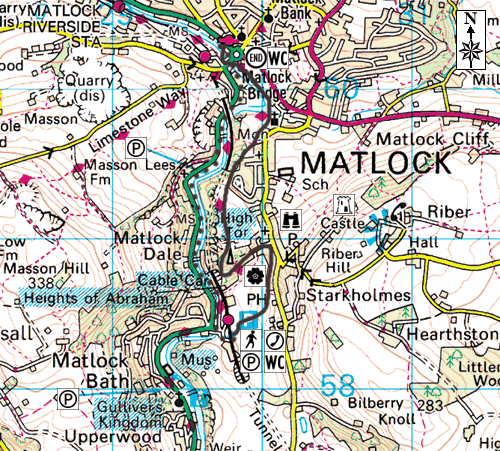
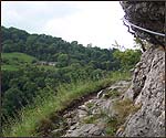
| The path which runs alongside the railway track. |
Whilst you're here, why not pop into the centre to pick up some leaflets on the kinds of wildlife you'll find? Derbyshire Wildlife Trust base themselves at the Whistlestop Centre and their staff and volunteers are always eager to share a bit of local knowledge.
When you're ready to start walking make your way onto the station platform and you'll see a level crossing. Walk over it and turn left onto the path.
The path veers to the left and brings you out at the base of the Heights of Abraham...
An opt out point here - turn left under the bridge and you'll be taken back to the A6.
There's also the opportunity to catch the cable car here and head off in a totally different direction.
You can make it up to the Heights of Abraham adventure gardens, into the caves - Great Masson Cavern and the Great Rutland Cavern - and Nestus mine where you can experience what it was like to be a 17th Century lead miner. And of course the views from Prospect Tower are absolutely amazing.
From these high vantages there's concrete proof of how the sea, volcanoes and ice have shaped the local landscape...but more about that later.
Matlock Bath
is an adventure playground for people who thrive on adrenaline. The magnificent
limestone crags are perfect for rock climbers and boulderers.
The River Derwent which hugs tightly to the limestone is a choice spot
for canoeists and kayak enthusiasts. And one of Matlock Bath's more curious
attractions is that it lures hundreds of bikers who line the streets on
a Sunday afternoon shining and showing off their machines.
Our route takes us away from the modern world though. We're taking a walk through time where we'll be appreciating some of the geological, botanical and historical riches of this area.
Instead of walking straight ahead to the cable car base station, turn to your right and you'll see the gate pictured above. This will take you onto another easy climb again with a firm surface.
It's an area of ancient landslip, a process which started many years before our time.
The rolling, hummocky terrain is the giveaway characteristic and the slippage is so significant in the Starkholmes area that the highway has moved in one or two places.
The evolution started 10,000 years ago, just after the Ice Age. At this point the landscape would have been bare with no vegetation. The ground would have been frozen and any rain would have merely run over the ground.
The landscape would have been quite unstable because of this dynamic activity.
In modern times a similar action has been taking place as man sparks off a catalyst with property and highway developments.
Just one
example of modern life mimicking the land's natural progression.
 |
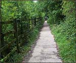
| Gravel path to the gate into the woods |
Peer onto the hill and you'll spot lots of pretty houses nestled in the hillside, many of these are holiday cottages. Unfortunately, for the owners, it's a fact that these houses will be moving, albeit very slowly, down the hill.
The slippage isn't too bad in this area and shouldn't be a great concern to home and landowners but in places like nearby Castleton the landslip has been more assertive, actually resulting in the closure of a road.
At the top of the hill you'll come out into a cluster of cottages and a series of winding roads. Stick to the main thoroughfare and look for a wooden signpost leading you leftwards and towards a latch gate which takes you into the woods.
This stretch of the walk takes you through luscious woodlands. The hedgerows are teaming with wildlife. Depending upon what time of year you're here you'll see plenty of birds, butterflies and possibly, if you're around at dusk, a few of Derbyshire's resident bats.
The two species of bat you're most likely to bump into here are the Daubenton's and Pipistrelle bats.
| Other wildlife you can look out for on your walk |
| Moths
- Carpet moths, Hawkmoths, Yellow Underwing, Magpie moths and Dark
Arches. Butterflies - Gatekeeper, Meadow Brown, Skippers, small Coppers, small Heath, Speckled Wood (summer varieties). Brimstone, Orange Tip, Common Blues and Holly Blues (spring varieties). Insects: Crickets, Ground Beetle, Violet Beetle, Shield Bugs, Plant Hoppers and Dung Beetles |
Daubenton's bat is a medium-sized species. It's suited to this area mainly because of the nearby River Derwent. It's a steady flyer, often seen skimming within a few centimetres of the water's surface and is reminiscent of a small hovercraft.
Daubenton's
bats feast on insects close to the water surface. They have been seen
taking prey directly from the water surface, using their large feet as
a gaff or the tail membrane as a scoop. Daubenton's bats fly at about
15mph. Generally they eat small flies, midges, Caddis flies and Mayflies.
These little furry creatures roost in trees and tunnels, bridges, caves
and mines - another reason they're particulary suited to this area.
At this stage of the walk the route zig zags through the woods and as well as the birds and bugs you can do a bit of tree and plant spotting.
Kids may like to start a plant detective scrap book, picking up leaves and finding out later which tree or plant they belong to.
Or why not take a camera so you can capture some of different butterflies, birds and berries and then find out what they are when you get home?
There's still plenty of heavy metal in this area. Lead, zinc and cadmium are just three of the materials the earth is rich in.
The land also hosts Barytes which was important in the paint industry and for making paper. It's a heavy, dense mineral which is also used in North Sea oil extraction because of its stabalising effects.
Fluorspar
(calcium fluoride) - which has a cubic crystal - is common in Derbyshire
and more specifically anywhere where there's plenty of limestone. The
leadminers of the past would have found it and disregarded it. In recent
years man has returned knowing that where there was lead there'll be fluorspar
and barytes. The examples we spotted had a slight orangey tinge indicating
a slight iron contamination.
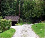
Early indications of leadmining activity can be found in the caves along this walk, look out for miners pick marks on the walls. This shows where the lead has been extracted from the surface of the rock. Miners would have tapped away at the lead leaving vertical scratch marks behind.
Access to both has been restricted at the moment on health and safety grounds. Though they're called caves, this isn't strictly true. They are actually mine workings.
Both are prime examples of open mineral veins. Spanning from three to 10 feet in width. The mineral has been totally extracted from these veins and today we're left with an open chasm to the surface.
Stop at the caves and have a good look around making sure you don't pass the boundaries.
 |
| Caves |
It's an important spot here as we can clearly see striations - scratches made on the rock surface, generally parallel, inscribed by a geologic agent, i.e., glaciers, streams, or faulting on the limestone.
The examples
here are perhaps 300 million years old and a result of earth movements.
The two pieces of rock have slid horizontally against one another and
left scratch marks on the surface.
Lichens pollinate
on the rocks' surfaces here, they can be quite misleading, some of them
are pale and look similar to crystals whilst others have a rusty tone
to them leading you to believe you're seeing iron deposits or fluorspar.
Matlock Bath and Matlock would have certainly been underwater around 330 million years ago - during the Carboniferous period.
This would have been an era of great development for Matlock's limestone but the area would have been totally unrecognisable.
Imagine the Bahamas and you'd have a better idea how the area would look.
If we'd been around at that time we'd have been living in a tropical atoll, a lagoon with beautiful corals and teaming sea life, from the minutest of shell fish to huge sharks.
There'd have been clam like species (brachiopods), sea lilies (crinoids) and other ancient creatures all co existing in this shallow tropical sea.
Eventually the tropical seas became overwhelmed by muds and sands from the north, big river deltas spread sands and silts across the area this was a precursor to the coal measures.
The plant and sea life perished and was eventually buried below the silt.
All of the coal measures and swamps have eroded away from this area and this has again revealed the limestone along with a few fascinating fossils that have been left over.
It's hard to believe that Derbyshire's limestone was actually formed about 15 degrees south of the equator. Over the last 300 million or so years they've slowly travelled to Derbyshire.
This view point will reward you with fabulous vistas over Matlock Dale and the River Derwent.
We're on the lower flanks of High Tor here and peering down you'll see the scree debris which has come down from the rocks themselves. The River Derwent is below but is completely hidden by the trees during spring and summer.
The view takes in pastures and wooded hills and you'll be able to make out Masson Hill which climbs to over 1000 feet on the far side of the valley.
For those who want to explore the other side of the valley there's an alternative to walking. You can of course take the easy route via the Heights of Abraham cable cars.
On the far side you'll see more limestone crags. And there's plenty of evidence of volcanic activity which happened during the carboniferous period.Volcanic lavas would have spread out across the limestone area and the pasture. In fact you can even spot some lava to this day. It's not quite as impressive as visiting Pompeii though. The lava here in Derbyshire has decomposed to a sticky, yellow clay and can sometimes cause problems in this area with instability - another cause for the landslip in this area.
Look out for the Beech tree which seems to be holding on to the rock for dear life as you walk up towards the summit of High Tor. It's a very spectacular sight. It suggests that the track has been widened and modified. The beech tree's roots have been left very exposed. It's a rare opportunity to see at eye level the rooting system of a tree and evidence that Beeches have a very shallow root system.
 |
| Giddy Ledge |
After your Giddy Ledge adventure it might be an idea to chill out and enjoy some of the botanic delights of the area.
Depending what time of year you visit you may be lucky to see a selection of plants that are peculiar to the area because of the toxicity of the ground.
Look out
for Eyebright (Euphrasia officinalis). It's an elegant little plant, two
to eight inches high. Eyebright flowers from July to September, with deeply-cut
leaves and numerous, small, white or purplish flowers variegated with
yellow.
Derbyshire has its own orchid too and you'll see it in July and August on this walk.
The Broadleaf Hellebore is quite unusual to the area. It's another one that thrives on the lead content. Unlike its tropical counterpart, the flower's possibly a bit insignificant but none the less a special plant for this area.
At this point you'll also see a classic example of Victorian folly. The little lovers nook and bench is a perfect place to shelter if it rains or just to catch your breath. Make a bit of time here to look for little fossels in the limestone and chert before the climb up onto High Tor.
The owners
used to charge the public to visit the gardens and the view points, even
if you took the alternative route and actually climbed the rock face.
It's possible the area is still beautiful and preserved because it wasn't
used as a general thoroughfare.
High Tor was once known as Eagle Crag, this is because Fish Eagles used to nest here.
To the right
there are glorious views of Riber Castle. The castle dominates the country
side around Matlock.
It is perched on a hill 260 metres (850 feet) above sea level. Gothic
and forbidding this grand old building which currently stands empty would
not look out of place in a horror movie.
Designed
and built by John Smedley it's made from local gritstone.
The castle remained derelict for many years until, in the 1960s, a group
of zoologists set up a nature reserve. The centre closed in 2000 and more
recent developments could lead to Riber Castle being revamped as luxury
apartments.
During its time as a Zoo Riber played home to birds, otters, lynx, goats and reptiles as well as wallabies and peccaries - musk hogs similar to wild boar generally found in deserts.
A playful
rumour suggests that a mischievous group of wallabies escaped the confines
of the zoo and sought refuge in the woods around Matlock and Matlock Bath
so keep your eyes peeled for some cute marsupials on your walk.
 |
| At the base of High Tor, head towards matlock now. |
Follow the grassy path now down towards Matlock's Victorian parks. You'll pass through a gate (see picture right), turn left here and head down into the valley under stone bridges.
This is a perfect spot to see the limestone from a different angle. As you walk along the bottom of the cliffs you can peer up at the impressive rocks.
Eventually you'll come to a well kept grassy area, make your way towards the stone pillar, then up the stone steps and over the small bridge. Turn left and walk towards the parks.
If you've still got some energy you could finish off the walk here with a game of tennis, round of miniature golf or boating on the lake. Kids can catch a ride on Little David - the miniature train that runs along the riverbank park or enjoy themselves in the play area.
The park
was transformed from Hall Leys public fields in 1898, complete with bandstand
where Matlock's Brass Band perform. Started to 'promote the education
and performance' of music locally, the band has been going for 150 years
and recently qualified for the National Brass Band Finals.
| Park Life- keep your eyes peeled next to the Derwent for: |
| Fish
- Roach, Perch, Tench and Pike Birds - Dippers, Kingfishers, Grey Wagtails. Animals - Otters, Foxes, Stoats, weezels, Water Voles and Mink |
Today the park is a calmer spot in which to recharge your batteries before hitting the hustle and bustle of Matlock's shops and cafes.
Early next year skate boarders will start to become a familiar site as a current restoration project will include a skate park as well as new play equipment.
The park ends at the medieval Matlock Bridge which dates from the 15th Century. Traditionally one of the few crossing points over the Derwent it was painted by the artist Joseph M. W. Turner.
Matlock train station is the end of the line for the walk. In its heyday trains used to stop here on their way to London and Manchester and thanks to the trade brought in helped Matlock develop into the town it is today.
For those who wish to make the walk a circular one you can walk along side the river derwent and back towards Matlock Bath.